

Now Reading: Top 5 Best Places Visiting in Bagalkote for History, Culture & Spirituality
-
01
Top 5 Best Places Visiting in Bagalkote for History, Culture & Spirituality

Top 5 Best Places Visiting in Bagalkote for History, Culture & Spirituality
1.Badami Caves

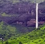
People can find the Badami cave temples within the town district of Badami which exists in the north-central part of Karnataka state in India. These temples exist at a distance of 142 kilometers (88 miles) from Belgavi (IATA Code: IXT) and 140 kilometers (87 miles) from Hampi. The Malaprabha River exists at a distance of 3 miles (4.8 km) away from the location. The cave temples exist 14 miles (23 km) beyond Pattadakal which has UNESCO world heritage status and 22 miles (35 km) beyond the Aihole complex which contains greater than one hundred ancient Hindu and Jain and Buddhist monuments.
As its former Chalukyan capital Badami features various temples from both the 6th and 7th centuries with both architectural and cave-cut religious edifices. Pulakeshi I (535 – 566 AD) established Badami while his son Kirtivarman, the Ist (567 – 598 AD) built many temples and additional buildings throughout the city which would later be known as Vatapi.
On the occasion of Vishnu image installation Mangalesha (598 – 610 AD) brother of Kiritavarman I completed the cave temples while giving the neighboring village to the temples as an endowment. Pulakeshi II (610-642 AD) ruled as the most powerful monarch of the dynasty by successfully defeating the Pallava King Mahendra Verman I among many victories. The Pallava attacked and razed Badami as retaliation after their loss before Badami shifted under control of various rulers including the Vijayanagar Kings, The Adil Shahi dynasty, The Savanur Nawabs, The Marathas, Hyder Ali and concluding with British ownership which led to Badami becoming part of the Bombay Presidency.
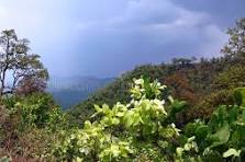
2.Aihole

The Hindu mythologies include Aihole as one of their significant locations. Natural rock formations on Malaprabha river banks north of the city form the shape of an axe while two rocks in the river stream display footprints. These legends describe that Parashurama washed his axe after slaying exploitative Kshatriyas in this region thus turning the land’s color to red. According to a traditional story dating back to the nineteenth century local people believed those rock footprints at the river to belong to Parashurama. Evidence of prehistoric human settlement exists at a place close to the Meguti hills. The town of Aihole contains great historical importance as it serves as a birthplace of Hindu rock architecture.
During the early Chalukyan dynasty (6th to 8th centuries) Aihole functioned as the dynastic capital while now it exists as a charming riverside village along the Malaprabha river. The site which the inscriptions name Ayyavole & Aryapura holds historical status as the birthplace of Hindu temple architecture. The town has 125 temples that belong to the 22 groups stretching from settlements to surrounding agricultural areas. This time period between the 6th and 8th centuries marks when most temples were constructed and several existed even prior to this time period.
Today we can only detect minimal archaeological evidence that remains from the 6th century fort. The prehistoric sites discovered in Morera Angadigalu near the Meguti hillocks within Aihole region number in high numbers. The evaluation of some holy sites near temples exposed early antique pottery combined with pre-Chalukyan era brick building materials. Archaeologists continue daily temple excavations to reveal powerful architectural research conducted in Aihole during its time more than 1400 years ago.
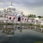
3.Mahakuta

The Mahakuta group of temples exists in the peaceful Indian village of Mahakuta within the Bagalkot district of Karnataka. Religious Hindus highly prize this site while it also contains a renowned Shaiva monastery. The temples within this complex existed during the 6th or 7th century CE when the initial Chalukya dynasty of Badami reigned.
Religious activities and devotion take place at Mahakuta because it stands as a Shaiva pilgrimage center. The Shaiva monastery found in this area underlines a prolonged Shiva-worshiping tradition which has been practiced throughout the region. Numerous devotees travel to the sites for blessing experiences where they also perform traditional temple ceremonies.
Significance
WThe temples at Mahakuta exhibit a unique blend of Dravidian and Nagara architectural styles, similar to the temple structures found in nearby Aihole. The intricate carvings, sculpted pillars, and elegant sanctums are testaments to the skilled craftsmanship of the Chalukyan era. These temples stand as historical markers of Karnataka’s rich temple-building traditions.
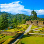
4.Kudalasangama
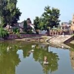
Sangam Kudalasangama (also Kudala Sangama) in India is a great place of pilgrimage for Lingayats. It is approximately 15 kilometres (9.3 mi) from Almatti Dam, in district of Karnataka state, in Bagalkot. Krishna and Malaprabha River rivers meet here and move east to Srisaila (other holy city) Andhra Pradesh. Located here is the vicarage of The Aikya Mantapa or the Samādhi of Basavanna the founder of the Lingayat sect of Hindu faith along with Shiva Linga which is said to be Swayambhu. The Maintenance and the Development is taken care by the Kudala Sangama Development Board[2].
KUDALA SANGAMA most historic place since around 800 years. Here both the famous rivers Krishna and Ghataprabha merge and flows towards Srisaila (another historical place ) of Andra Pradesh For the improvement of this historical shrine Government has constituted a Kudala Sangama Development Board and almost Rs. 45.00 Crores has been sanctioned to developed this places as one of the most sought out piligrim centres. Shown herewith are some of the poorest taken photo’s of the recent works undertaken to enhance the pilgrim centre. Kudala Sangama is 15 km duluth from Almatti (Dam Site ) and 45 Kms too effectuation regard from Bagalkot.
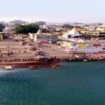
5.Almatti Dam

Almatti Dam is a hydroelectric project on Krishna River[1] North Karnataka, India, was completed in July 2005. The annual target of dam electric power production is 560 MU (or GW, GWh).[2]
The Almatti Dam is the command reservoir of Upper Krishna Irrigation Project, the 290 MW power house is situated on Almatti right bank. It employs vertical Kaplan Turbines, five twenty eight MW generators and one fifteen MW generator. Water is discharged to the Narayanpur reservoir after being used for power for the purpose of fulfilling the downstream requirements of irrigation. Two separate facilities namely, Almatti 1 Powerhouse & Almatti II Powerhouse each located at a different distance does transmit power.
Initially, while formulating the project, the estimated cost was estimated to be around Rs.14.70 billion, but later after handing over the project management to the Karnataka Power Corporation Limited (KPCL), the estimated cost had come down by more than fifty percent to the negotiating price of Rs.6.74 billion. The KPCL finally did the project at yet lower cost Rs. 5.20 billion.[citation needed]The total dam was constructed in less than forty months and completed in July 2005. Dam is situated only on the border of Bijapur and Bagalkot districts. Located in the Bijapur district geographically but because of its formation of reservoir large areas of Bagalkot district also been under water. The dam is having a gross storage capacity of 123.08 TMC above 519 meters MSL.
Related articles : Top 5 Best Places Visiting in West Singhbhum for Nature, Heritage & Spirituality


Pingback: Best Places Visiting in Ballari – Explore Karnataka's Heritage